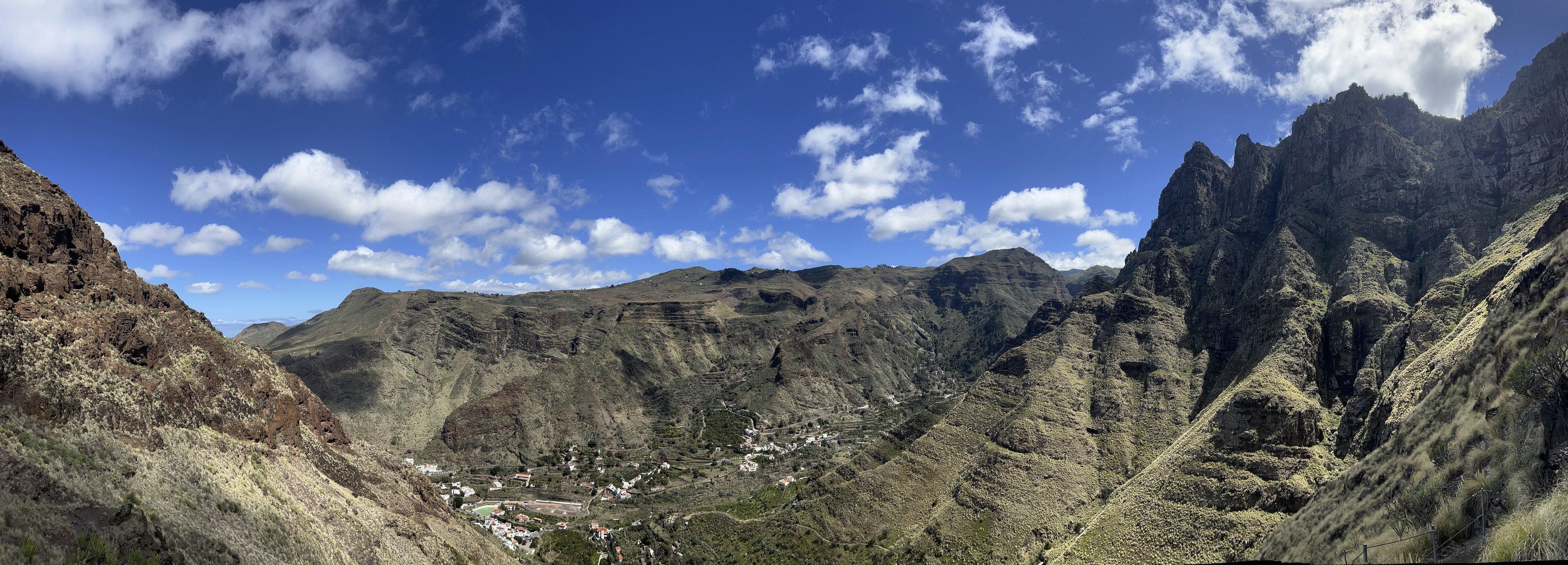

A Guide to Gran Canaria’s Wild Side#
Tamadaba Natural Park, one of Gran Canaria’s most pristine and untouched natural areas, offers breathtaking hiking trails through ancient Canarian pine forests, dramatic cliffs, deep ravines, and stunning coastal views. Located in the northwest of the island.

🥾 Best Hiking Trails in Tamadaba Natural Park#
1️⃣ Agaete to Tamadaba Summit Trail#
- Distance: ~12 km round trip
- Duration: ~5-6 hours
- Difficulty: Moderate to challenging
- Elevation Gain: ~1,200m
- Start: Agaete or San Pedro
- Highlights:
✅ Ascend from the lush Valle de Agaete into dense pine forests
✅ Spectacular views over the Agaete Valley and the Atlantic Ocean
✅ Lookout points such as Mirador Llanos de la Mimbre
✅ One of the best hikes for a full mountain-to-sea experience

2️⃣ Tamadaba Forest & Risco Faneque Trail (Best for Views)#
- Distance: ~8 km round trip
- Duration: ~4 hours
- Difficulty: Moderate
- Elevation Gain: ~500m
- Start: Llanos de la Mimbre parking area
- Highlights:
✅ One of the highest coastal cliffs in Europe (1,027m high!)
✅ Stunning panoramic views of the Atlantic, Agaete, and Tenerife
✅ Well-marked trail through the Canarian pine forest
✅ A shorter but rewarding option for amazing landscapes

3️⃣ Guayedra Loop – Mountains to the Beach (Best for Variety)#
- Distance: ~12 km loop
- Duration: ~4-5 hours
- Difficulty: Moderate to challenging
- Elevation Gain: ~800m
- Start: San Pedro or Agaete
- Highlights:
✅ Mix of forest, ravines, and coastal trails
✅ Stunning views from Tamadaba’s cliffs
✅ Descend to Guayedra Beach, a remote black-sand beach
✅ Coastal return trail with breathtaking ocean views

4️⃣ Circular Route: Tamadaba Pine Forest & Viewpoints (Best for Nature Lovers)#
- Distance: ~10 km loop
- Duration: ~4-5 hours
- Difficulty: Moderate
- Elevation Gain: ~600m
- Start: Llanos de la Mimbre parking area
- Highlights:
✅ Deep forest immersion—perfect for a peaceful hike
✅ Explore ancient Canarian pines and native plants
✅ Multiple miradors (viewpoints) overlooking the coastline
✅ Good for hikers looking for a quiet, nature-focused trail
🌤 Essential Hiking Tips for Tamadaba#
✅ Bring Plenty of Water & Snacks – No shops or water sources on the trails.
✅ Wear Sturdy Shoes – Some sections are rocky and uneven.
✅ Check the Weather – The mountains can be cool, windy, or misty, even if it’s hot at the coast.
✅ Navigation – Trails are generally marked, but offline maps (e.g., Maps.me or AllTrails) are useful.
✅ Respect Nature – Tamadaba is a protected area, so leave no trace.
🚗 Getting to Tamadaba Natural Park#
- By Car:
- From Las Palmas: ~1.5-hour drive via GC-2 and GC-200.
- From Agaete: ~30-minute drive to Llanos de la Mimbre trailhead.
- By Bus:
- Take Global Bus 103 from Las Palmas to Agaete.
- Then taxi or hike up to the trailhead.
Why Hike in Tamadaba?#
🌿 One of the most unspoiled areas in Gran Canaria
🏔 Diverse landscapes: mountains, forests, and coastal cliffs
👣 Well-marked trails for all hiking levels
🌊 Breathtaking views over the Atlantic and neighboring islands
Comments
No comments yet. Start the conversation.